Monday, October 13, 2014

Cochise County Cycling Classic 2014

Can't believe it's been a year since I went down to Douglas to do the Cochise County Cycling Classic bicycle race last year, but time flies.

Have been training but have had a little bit of trouble trying to get the right intensity going since doing TD and Barnburner.  It seemed like I was loosing a bit of edge or something and not finishing both of those races was starting to gnaw on me.  So I really wanted to do well at CCCC this year.

Lauren and Jennifer had volunteered to SAG for me this year, so the three of us loaded up and headed for Douglas on Friday.  Got the packet stuff at the Fairgrounds and then off to the Gadsen to check in.  We were hungry so walked up the street to a Mexican restaurant which was pretty good.  The waiter was more intent on doing his homework, but the food was good.  We finished up and went to the Fairgrounds for Dinner #2 a plate of spaghetti.  Met Sarah and Sandy there and saw Carolyn who was also doing the 165 race that I was going to do the next morning.

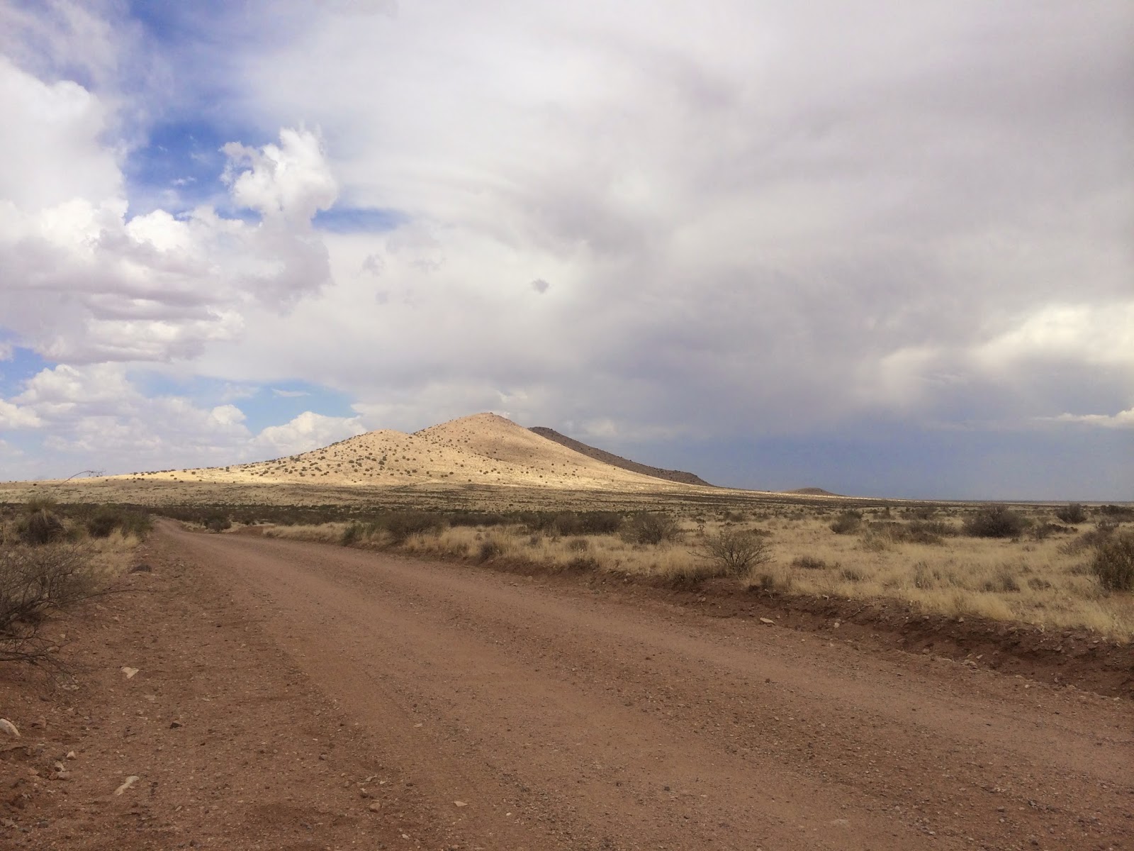
Headed for Tombstone

Up at 5, out of hotel at 5:30, lined up for a 6:30 start.  Pretty warm, had a light jacket and handed it off to Jennifer and away we went.  I don't think I pushed as hard as I did last year in the early part of the race ... last year the 92 mile people passed me a bit past Cochise College and this year they passed me after the Mule Mountain descent, so that part didn't seem to make a lot of sense.  I was with the second group of fast 92 people, with Dan and some other guys, but could only hang with them for about a mile or so, then ever so slowly, found myself dropping off the back end and alone again.

Lauren and Jennifer kept fixing me up with fresh bottles of water and Carbo-Pro and snacks from our cooler and I kept going.  Pretty soon we were in Benson at Ocotillo Road where they waited for me to get up I-10 towards the Dragoon exit before they left and then met me at that exit.

Kept rolling along and getting resupplied and kept going and pretty soon the race was over.  We had a great day, not much wind at all... I could see the smoke from the Apache power plant going straight up as I closed on US 191 ( a really good sign ), and no wind in my face this year when I saw that sign that said 57 miles to Douglas.

I think we kept the stops short, kept the calories and hydration going in.  Didn't eat a lot of solid food at all, mainly GU's, some chips and Cheetos, but a lot of juices, the Carbo-Pro, a few 5-hour's, some AZ iced teas and San Pelligrinos and that seemed to take care of things.

Finished with about 9:53 of elapsed time for 164 miles, about 1:15 faster than last year, so I was really happy with my time.  And it was 9th place out of 23 entrants.  Good to have a success under my belt.

World's Best SAG Crew !

Back to the hotel, a couple of Margaritas, and a late night party which woke me up, that was on the balcony outside of my room, but it was all ok.  We had a good ride back to Tucson, except for my bicycle falling off the roof rack somehow ... we hear a big "thump", it wakes Jennifer up, I look in my left mirror and see my bike hanging off the driver's side of the car ... get to the side of the road and reattach it ...  it seems to be ok, but what a scare ... not sure what happened with that !

Next event is Bike the Coast a Team in Training event in Oceanside, CA on Nov 1


Sunday, September 7, 2014

Barnburner - incomplete day

Off to Flagstaff for the Barnburner MTB.  It's a mountain bike race held on a bunch of forest roads just northwest of Flagstaff.  The 104 mile race that I signed up for is 4 laps of 26 miles each, around the Kendrick Mountain Wilderness.

Get there on Thursday and get my packet. Off the next morning to find where the event is going to be held. The instructions on the riders guide published online plainly say to take a right where 245 runs into 171.  So me and a bunch of guys in a truck with mtb bikes on it in front of me both did, and promptly managed to miss where the event is going to be held.  Only when we got west of the Kendrick area did we figure out what we had done.  Back to the intersection, take the left, then about 1/4 mile or so and take a right across a bunch of pasture and we were where we were supposed to be.


Got the bike out, rode about 5 miles or so in each direction, and then headed back to Flag.  As I was getting to the hotel a cloudburst came down, which was the same big rain that would turn the parking area at the event into a mudhole.

Went out to eat something on Fri night and was feeling really bad.  I have been at altitude before and still don't think that was it, but when I looked something up, the symptoms all seemed to match.  Long and short of it is that I wasn't sure at 8pm if I would even get up and go to the race in the morning or just go home.. I felt that bad.

4 am comes and I get up, say screw it, and head for the event.  No breakfast places open, so bananas, coffee, a fruit bar and a gel for breakfast.  Navigating my Subu through that field of mud was interesting, watching pickups in front of me spinning and turning 90 degrees in the mud !   The race start area was pretty muddy, and they cancelled the Lemans start normally held ... we just did a standing start at 7am right by the wooden gate that fronts FR 793.

My first lap felt pretty good, considering I was seriously thinking about packing it in the night before.  I finished up and took a detour after passing the timer, to my car and had some chips, a Coke and some other stuff.  Then back to the course.  I also dropped off my rain shell which I had for the first lap.  The sun was out, it was nice and warm and the course was drying out, just really pleasant.

My second lap also went pretty good.  Other than getting out of control on a descent and electing to just run off the road into the weeds rather than try to "save it" ( which worked well, by the way ) I didn't have any trouble.  Through the barn, and got a time ( which included the actual ride plus time between 1st and 2nd lap eating something.

Off and away from the car for the third lap.  It also seemed to go well, until big drops of rain began to fall and my rainshell was left in the car from the end of the 1st lap.   A pretty amateur mistake, made when I was trying to hurry back out.  So .. I got wet, as in really, really wet, along with being really, really chilled. We had a very cold rain, lots of hailstones ( little ones, but they stung ! ), and I rode pretty hard trying to generate some heat.


When I went through the barn for the period between the end of 3rd and the start of 4th, I had every intention of finishing, but I needed to go for the car again, to eat something and to try to warm up.  I was starting to shake a bit from the cold and I fired up the car to run the heater and try to warm a bit.  Was pretty sure they announced the cutoff time had been reached, and I was still at the car.  Technically I could have got back on the course, but I was still really cold and I kept the heater on all the way back to Flagstaff.

So.... two take aways ...  just keep the rain shell at all times, even if the sun is out, and for Barnburner, I noticed that lots of solo folks had a little support crew there with their goodies right outside the barn, nice and close to the course.

Next up, back to do the Cochise 164 mile ride again, along with Bike the Coast in Oceanside and El Tour de Tucson.  Lots to be done !

Wednesday, June 25, 2014

Tour Divide 2014 Day 10 Falling Apart & Done

It was a pretty clear night in the dewey grass in front of the restaurant at Horca and I got cold.  It seemed that it was colder than on top of Burned Mountain, even though the elevation was a couple of thousand feet lower.  My mind started worrying about the brakes that weren't quite right on the bike.  I had problems slowing down on the descent down La Manga Pass into Horca last night, and now I was beginning to fear going further into Colorado and having to deal with the passes there.   I didn't want to give it up and thought that I might be able to get up hill, figure something out where my phone would work, maybe get to Santa Fe and get the bike fixed and then continue on.

So when the sun came up and finally warmed the sleeping bag, I was cold and tired, thinking my gear is not up to the task ahead.  I packed it all up and then I sat at the intersection of FR150 which would lead to Platoro, CO and Highway 17 that would lead back up La Manga Pass to Cumbres Pass and then down to Chama, NM.  Couldn't figure out what to do and I just sat there.   Then something made me head up that 9 mile hill and that started the end of my ride.

The ride up La Manga was nice.  I got into a good climb, it was a little bit steeper than Mt Lemmon, but not that big of a deal and the sun was out.  I stopped at the top of the hill, saw a couple of road cyclists, and then crossed a railroad track for the Cumbres and saw the train station that appears in the "Ride the Divide" movie ( where the fellow says "this here's Bandit").   A few hikers were there and we could hear the train in the distance and I waited for it to show up.  A fully functioning coal driven steam locomotive.  Interesting to watch the support crew at the top of the pass with their infared thermometers checking on the temperatures of various connecting rods and wheels.  The locomotive and train pulled away and I headed for Chama.

Train Schedule

Beautiful Technology
In Chama I found a restaurant and contacted my niece Lindsay for a ride to Santa Fe, with the expectation that I would find a bike shop the next day, get it fixed and get back at it.  But someplace on the long drive to Santa Fe ( it was nearly 100 miles - was surprised at how long it took in Matt's jeep at 60+ mph to get there ), I guess I gave up.   I stayed with Amanda and Dustin that night and the next morning we loaded the bike into Amanda's car and went looking for a rental.  Had to go to Albuquerque to get a one way rental and around 2 pm or so, I was on I25 headed for Tucson.   When I passed the Continental Divide and the turn to Antelope Wells on I10, that I had taken 10 days before,  I was not a happy person, as I guess I really did just quit on myself, so I get to deal with that for the next year.  I didn't get saddle sores, I didn't even take an Ibuprofen, and other than being tired from riding 9 days or so in a row, I felt pretty good.   As they say this race, the Tour Divide, is more than physical, it is a lot mental, and as I said on my Day 1 blog post, I broke.

Well, the brake pads were worn down and both front and back needed bleeding, so it wasn't all in my head, but am still disappointed.  I did do a hard State, and did it by myself without any outside assistance, so I am proud of that, but as I sit here and look at the still active TD riders, I can't help but want to be out there on the Divide someplace.

I played a song "Silver Stallion" by the Highwaymen LOTS of times during the ride and these lyrics kinda hit a sentiment for me ... So Till Next Year


I'm gonna chase the sky forever,
With the woman and the stallion and the wind
The Sun is gonna burn into a cinder,
Before we ever pass this way again

And we're gonna ride, we're gonna ride
Ride like the one eyed jack of diamonds
With the devil close behind
We're gonna ride


Tour Divide 2014 Day 9 Brazos Ridge & Horca

It was a cold night on Burned Mountain.  A lot colder than I thought.  My sleeping bag ( Western Mountaineering ) was supposed to be rated to 25 degrees, but I was pretty chilled at different times during the night.  So the sun coming up and hitting me was pretty welcome.  And as soon as I started rolling I saw big RV's and knew I had crested Burned Mountain and was close to the Hopwell Lake campground that I had planned to get to in the first place.

At Hopwell Lake, I refilled my water, washed up a bit and then did a fast downhill on Hwy 64 until I got to FR133.  There was a short climb and then several miles of rollers through grassland and woods.  At one point I was above a creek and heard a group of animals and looked to the west..  I had startled about 25 elk and they were running up a hill out of shade into sunlight on green grass.  Since I was higher above the creek, I had a nice perspective on them, akin to what you see on Nature, where a film of a small herd of animals is taken from an aircraft.  It was pretty cool !

FR133 kept going and then turned into rangeland once again and got rough.  At some point I heard this banging around sound in front of me on the bike and looked down to see that my Garmin etrex had popped loose from it's mount and was dangling from the lanyard.  At some point I remembered reading on bikepacking.net that you should tie your Garmin to something because it WILL pop off and if it isn't tied down you're going to have to go back and hunt all over the road to find it.  Only took a few seconds to reseat it where it was supposed to be and then move on.   I crossed more rangeland, and finally got to the Rio San Antonito a really pretty little river.   Ate something at a grove of cottonwoods and then climbed more.  The rest of the early afternoon would be all climbing to the Brazos Ridge that overlooks the Cruces Basin Wilderness.

The sky got a bit darker and I am still climbing.  At one place a bit of rain started and I stopped and got my warm stuff on.  About 5 minutes later the sun came out, so then got to take the rain stuff off !   The road got harder to navigate and turned into a rock garden and then as I got closer to the top became mostly unrideable for me and I just pushed the bike up the mountain to the 11,000 foot level.

The top of Brazos Ridge was pretty.  Not very many trees and a little bit of snow under some of the trees in a couple of places.  On the north side there still was a drift of leftover winter snow.

And then it was time to descend and I began to realize that I didn't have a lot of braking power left.  My front brake had seemed weak for the last couple of days, but now the rear was a little weak also.  Once again, the map shows a good descent, but that's not quite true, there's always a hill or two around !  After several more miles, I see the sign that says "Leaving Carson National Forest" and one that says "Entering Rio Grande National Forest" and that is the Colorado State Line.

There were still a few miles to go to get to Horca, with a last little climb to cross the Cumbres & Toltec Railroad ( an old fashioned coal fired, narrow gauge, steam engine railroad ! )   Highway 17 was in front of me and I finally got to a 9 mile descent on pavement to Horca.

At Horca I found a restaurant and had a great meal, sweet iced tea, meat loaf, mashed potatoes, bread with honey !  Lots of calories went onboard.  But I didn't find a campground and I ended up back in the bivy in front of the restaurant and fell asleep.
Rangeland before the big climb

Top of Brazos Ridge

FR87 ( pretty rideable here ) on Brazos Ridge

Me

Slightly down from the high point of the Ridge - beautiful

Rio Grande National Forest - This is Colorado !

Cumbres & Toltec Tracks


Tour Divide 2014 Day 8 El Rito & Canon Plaza

Woke up and tried to figure out what day it was.  I am loosing track of time on this trip ! Apparently it's Friday morning and I have been out over a week now and I packed the bike and got ready for another big day.  This day would take me into the Tusas Mountains on the way to Colorado.  I didn't expect that  I would clear it all in one day, and planned to make Canon Plaza and maybe get to Hopwell Campground for the night.  Had a great breakfast at the Inn, and then headed out.  As I rode to El Rito a car slowed and a fellow asked me if I was doing the Divide.  He said he knew Mary from the movie, and gave me some encouragement.   The ride to El Rito was paved and went well.  In El Rito I stopped at a liquor store/grocery store and bought stuff for the night to come.  It was about 10:30 and the clerk said the restaurant in town didn't open until 11:30 and offered a shady place under trees in the back to rest, and I took him up on it and took off the Camelback, leaned up against it and napped for about an hour.

When I got up, I headed for El Farolito's.  Lunch was a burger, fries and a shake, and then a stuffed sopapilla with meat and beans and cheese, all wrapped up for the trip.  With that, a bunch of energy bars, some apples, and a couple of Cokes I headed out.  Right outside El Rito, the road turned to dirt with some sand and a bit of a grade.

Scene from "Ride the Divide" - a pay phone used to be on the left side of the building
El Farolito's   Great Mexican Food !  


The next village I would pass is Vallecitos, known for having a bunch of loose dogs, and I found that to be true ... as I entered the last part of the little town a Rottweiler came out from a house ( with the owner standing around in the yard, by the way ) and chased me.  I knew these guys were going to be there and out ran him, but he could be a little dangerous going the other way as there is more of a grade to go up.  I think some riders may even have used bear spray in the past on these dogs.   Another smaller dog came out, but he was slower and not as big of a threat.

At this point the road became paved and it was all the way to Canon Plaza.   In Canon Plaza is the "Summer Store", a little store operated out of a tuff shed building on the side of the road.  I stopped and saw their sign that says "Honk Horn".  Since I didn't have one, I tried the pickup truck with the forsale sign on it, but that horn didn't work.  Stood around for a few minutes and an old dog from a house came down to the store and lay down.  That appeared to be the house of the owners, so I waited and then went up to the house.  Checked the doorbell and no one home.  Then I ran into a puppy,  a little black and white felllow that still had that puppy smell  about him.  I wanted to take him with me, but no room in the Camelback.   So I decided to leave and headed up into the forest towards Burned Mountain.

As I climbed I passed an old mining camp with a pretty spring, and then began to smell smoke.  Yes, there was a small forest fire off to the south and west of the road that I was on.   For just a bit I was concerned that I might have a problem as I saw a little bit of visible smoke across the road, but the wind quickly cleared it.  Climbing further it was behind and the wind was blowing it away from me.  The shadows grew longer and longer and I climbed more and knew I was above 10,000 feet once again.  I knew I was close to the Campground that I had intended to get to, but it was getting dark enough that I decided to stop in a clearing where another FR91 piece turned off.  At this height as soon as the shadows lengthened it got cold.  So I drank one of my Cokes and ate the stuffed sopapilla and got ready for the night.

Another clear and cold night with coyotes howling in the area, more elk making noises in the night and an OHV that came from someplace down FR91B and then went down the FR91B-something and turned back.  Wasn't sure at all where he came from.  Next morning it was pretty apparent that he was from the campground area that was only about a mile over the ridge.  I was closer to the top of Burned Mountain than I though I was !

Burned Mountain Campsite
Supper - Delicious !


Tour Divide 2014 Day 7 Abiquiu

I knew the ride to Abiquiu was going to be hard and had some dread of it.  Out of the hotel and a short ride up the main street of Cuba, a right turn onto 126 and then out of town.  The road began to climb and I found myself with a Mt Lemmon type climb of about 10 miles.  The grade was a little steeper, but it all seemed to come together pretty nicely.  Near the top the route turned onto a Forest Service road and it was absolutely beautiful.  The grades were not that hard, the surface was good and I had my lunch sandwich of steak and tortilla packed away in my pocket.

As I neared 10,000 feet I began to run into rougher road and finally got to a place that I couldn't ride and just got off and walked.  A little bit of a rock garden.  Just above this the road was rough but still rideable, although hard, with me trying to pick out the right line from one side of the road to the other.  I was surprised at how much of the time on this whole trip that the right "line" seemed to be on the left side of the road...  in many cases it had either less gravel, less sand, a harder pack or a bit of all of those.  Not sure why that was the case, but lots of times I was following the track of the other riders before me and that's where they were also.

So, this piece of road went on for quite some time.  At one place I passed a fellow, his wife and little girl who were collecting small diameter trees, clearing off the limbs and making poles out of them.  They had an old pickup truck and the back bumper was almost on the ground from the weight of all of the poles that were in it.  How that truck would ever get off the mountain stayed in my mind for a while.

All in all this part of the ride went well, with more climbing and a glance at the Adventure Cycling map showed that I had a nice descent at the end into Abiquiu, so I thought I was doing well.  Then came FR27 !   This road started at a bit above 10,000 feet and would take me to Abiquiu.  The first couple of miles were not too bad, a bit rocky, but navigable.  Then I discovered what happens to missing beach sand on the Atlantic Coast -- it gets deposited on this road !   It became one long section ( downhill grade ) of sand and rock ...  reminded me of trying to ride in the Santa Cruz back in Tucson, hard to steer, hard to pedal, no real speed, just slugging through.  And again, when I though I was done, there were still several miles left to go.  But finally a sign showed 7 miles, then 5 and I knew it was almost done for the day.  Then a turn onto Hwy 84 and the search for a place to stay began.  I turned into the village of Abiquiu and found nothing there and looked at Bode's store and it was closed.  Finally asked someone pumping gas and he told me about the Abiquiu Inn just 1/2 mile east of where I was.

I was in luck, the Inn had a vacancy, and the restaurant was open, so I got a good meal, and a place to sleep for the night and get cleaned up.
Santa Fe National Forest Jemez Mountain Trail

Steep and Rocky at about 10,000 feet 

Tour Divide 2014 Day 6 Cuba

A 3am start for a road ride to Cuba.  No wind and dark when I left Grants, then Milan and up the highway towards Ambrosia Lakes.  It was surprisingly cold and I had little traffic, then it began to pick up as work related traffic for the mines began passing me.  I wanted to get this ride done before afternoon winds made it hard to ride.  The dark was nice to ride in, but my LED flashlight that I was using for a light would drop out every so often.  Not sure if it was battery related or something in the light, but I switched it out with the spare I brought and rode into the sunrise.


Sunup
Once I passed the Peabody Energy El Segundo mine the traffic dropped to nothing.  The mine was off in the distance and was surprisingly smelly, considering I was a long way from the diesel engines being used to rip the coal from the ground.

Coal mine ( with dragline in the center )

Still have base layer on
 I continued riding to White Horse and then up to Pueblo Pintado, where the route turned a bit southeast towards Cuba.  Made a stop at a combination laundromat and convenience store along the reservation and talked to the owner.  He sees all of the TD riders, its the only thing out there for miles in each direction.  Lonely country.

Empty country

And for a time I thought it looked exactly like a piece of Wyoming that I rode across two years ago in the Big Ride on our way to Newcastle.  Rangeland with mountains in the distance.  There was a mountain to the southeast that could have been a stand-in for the Devils Tower.

Pretty
I kept seeing these little flowers growing through the cracks in the road.

Wyoming ( not really )
It was time to make some time and the wind was good, so didn't take any other pictures before Cuba.  I passed through more reservation country, saw a couple of fellows walking on the side of the road.  They jokingly asked for a ride and I waved.  About 10 minutes later I saw them in the back of a pickup truck and they waved at me as they passed.  And I also saw a lot of horses, just loose on the side of the road.  In one place there were about 6 of them.  A couple appeared to be spooked by my bike and I was glad they didn't run into the road and the light traffic passing me and them.

Had to stop outside Cuba for road construction where we got flagged through a newly tarred section of road.  Fresh tar on the bike and my legs and socks.  Then Cuba appeared and I went to the Cuban Place, and had a nice grilled ham and cheese and the usual gallon of iced tea and a chocolate shake.  I got there before they closed at 3, so maybe 10 1/2 hours for 120 miles.

El Bruno's was recommended, and I got their steak and enchiladas.  Was delicious and I couldn't eat it all and took the leftovers back to the hotel for the next day's ride to Abiquiu.  It would be a hard ride of nearly 80 miles across the Santa Fe National Forest.

Tour Divide 2014 Day 5 Grants

The Good Pie Cafe wasn't going to open until 11 am, and I thought I needed to go earlier, so I ate another pizza for breakfast and started to Grants.  The wind was behind me and the first thirty or so miles were on dirt.  I rolled quickly on a good surface and got into open rangeland.  At one place I saw a cowboy and his dog herding some cattle across the road.  One of the calfs bolted and the dog corralled it, really cool to watch the rider and horse and dog working as one.

When I hit pavement I went past the El Malapais National Monument.  Saw some really interesting lava patterns in the rocks on the west side of the highway and then got my picture taken by some folks in front of one of the more famous features.

I think I got to the Subway at Interstate 40 at about 12:30 or so, and had a sandwich there.  When I left, the next 9 miles to the middle of Grants took a while to navigate with a seriously strong headwind.  Thought about leaving for Cuba, but I elected to stay the night in a hotel and spent the afternoon eating two more times and getting ready for a 3 am departure the next morning.


Lava swirls

Thumbs Up !

Tour Divide 2014 Day 4 Pie Town

The ride towards the mystery Collins Park continued in the early morning.  The road had a great surface and the ride went really quickly.  I got out of woods and a few small Continental Divide crossings and then found Collins Park, nothing but a crossroads and a cattle corral.

Collins Park
 After Collins Park, still in pretty smooth dirt and making good time, I go through a canyon and then open out onto the plain of San Augustine.  It was a area of ranch land, windmills and cattle in the distance and some washboarding on the road.  After some time, I finally get to Highway 12 and Horse Springs Baptist Church.  As Matthew Lee says in the movie "this place is a blessing to a lot of riders" and it was for me with cold water and a shaded porch to eat my orange on and rest for a bit.
Wide open spaces south of Hwy 12

Horse Springs Church
 The afternoon brought a climb into mountains and then a descent towards Pie Town.  Once again, I was swayed by the appearance of a descent on the profile chart of the Adventure Cycling map.  But when you actually start riding, you find there are still a few hills and rollers to be navigated, and they can take a toll on you.  A little bit after 3 pm, I was happy to find Pie Town and as a bonus to find that the Good Pie Cafe was OPEN having just recently changed their hours.  A green chile cheesburger, fries, two Cokes, three glasses of ice tea and a large chocolate mileshake had me feeling a bit better.  The folks at the Good Pie Cafe were really helpful and told me where the Toaster House and the RV Park were.

The RV Park had the shower and it was awesome to get four days of dirt off me and into clean clothes.  And then I got to go up to Nita's Toaster House and spend the night there, eating one of the pizzas, and drinking a PBR.  I had the place to myself and it was just a wonderful, unexpected and great place to get to after roughly 150 miles since Silver City,
You have no idea how good this was

Penthouse at the Toaster House

Toasterhouse Kitchen

Toasters

Tour Divide 2014 Day 3 Beaverhead

Sunday morning, I get up, had my last Coke and some fruit and start for the Beaverhead Work Center.  The going was pretty good for a while, a bit washboarded and then I got to Black Canyon.  At Black Canyon I found a running stream and I went down and filtered some water as I was getting low.  First time filtering with the SAWYER filter and it seemed to go well.  Black Canyon had a pretty impressive descent into it, and then a climb out of it.  It was starting to get hot and having that full bottle of water made all of the difference.
Black Canyon water supply

As the afternoon wore on, I finally passed Wall Lake, which is private with lots of No Trespassing signs all over the place.  I got hotter and the camelback ran out, and I was into that bottle of water that I filtered at Black Canyon.  I used my last 5 Hour Energy and then slowly, but slowly got to Beaverhead.  They had this big beautiful water faucet and I filled everything and then took a nap on a wooden bench under the trees.   After a bit some of the horses came over and I petted the mule.  Some of the fire fighters came out and were spraying bees and I started a conversation with them and asked them if they had a Coke machine someplace ( since the one by the door has a big Out of Order sign on it ).  They gave me two Cokes, an apple and an orange and I was sooooo grateful for that and was on my way.
Beaverhead nap bench
Beaverhead Work Center

Much more energized, I rolled for several miles into O-Bar-O canyon and found this little piece of road with flowers growing in the middle of the road.  The canyon was like a wind tunnel as it aimed mostly west and the wind was coming from that direction.  At one place I see a sign for a place called Collins Park that seemed to be just a general area on the map.  Kept riding on into the early evening and darkness, had some mule deer cross the road in front of me, and then finally came to a wooded area and found a place to camp out with a beautiful sunset.


O-Bar-O Canyon
Riding into Darkness


Tour Divide 2014 Day 2 CDT

Saturday morning, I woke up with cows grazing around me.  Packed it all up and headed into Silver City, past the Tyronne mine on pavement.  I ran into a cyclist at the first gas station that I came across and she recommended "Vickys" as a good breakfast place, so I headed there.  After breakfast, it was time to find some supplies and then head to Pinos Altos.  We get to make our second Continental Divide crossing right outside Pinos, and that was the last time my phone would work until I got to Grants, NM ( except for wi-fi in Pie Town ! )

Divide Crossing

Buckhorn doesn't open until 3 pm !  
 Got that last Coke and ice cream in Pinos and then up into the Gila National Forest.  After a few miles of forest road, the route connects with the Continental Divide Trail.  This was a pretty nice piece of singletrack, except for a few fallen trees.  The forest road had recently been graded to support the firefighting activity for the Signal Peak fire that happened in May, and it was loose and hard to ride on in several places.  I could see the tracks of the other riders before me, and at one place suddenly they turned around.  Zoomed in on my GPS and figured out that the trail was back a bit, and finally found it.  The CDT was fun to ride for the most part, with some interesting drop-offs in a place or two.  It finished at the Sapillo campground, and then I was on 35 for a little while until I turned onto FR150.


CDT was officially closed due to the Signal Peak fire
CDT Trail Markers and trail to the side

FR150 immediately started to climb and climb and climb, for about 6 or 7 miles. I stayed on it until sundown and then looked for a place to camp for the night.

Looking toward Mimbres from FR150
Darkness came and I lay on my back and watched the satellites go by.  Then I fell asleep.  A bit later, I was awoken by the sound of something moving, but it went away.  An hour or so later it came back, and in the moonlight of a near full moon, I could see a male deer and hear his hoofs on the ground.   He left and it was a good nights sleep.


Tour Divide 2014 Day 1 Separ

I broke.

I succumbed to the "black pit of despair" in the early morning hours, in a cold sleeping bag, lying in wet grass in front of a restaurant just into Colorado. Do I continue on to Platoro, just 22 miles up a forest road and move on from there, or do I ride back up 9 miles of La Manga Pass, and 21 more, over to Chama, NM and see if I can get to Santa Fe to fix my bike someplace ?  My already weak front brake was making a new noise the afternoon before and I was using almost only rear brake, but I might have been able to overcome that and get to Salida in three or four days and get it fixed.  I sat for three or four minutes, at the intersection of FR150 and 17 and thought, and then turned up La Manga and that was the end of my Tour Divide ride.  

So here is the story of my trip through New Mexico ( at least I got one State done ! )

We had started 10 days before, on June 13.  Paul drove me to Antelope Wells, NM, leaving Tucson around midnight and getting there at sunup.  We meet Big Dave, Brian, Mike and Tim, there would be five of us starting north. Gear got loaded, tires got their last pump and at about 6:25, Dave said a prayer and the five of us started out. I fiddled with my GPS for a minute or two and Tim was doing something behind me and Dave, Mike and Brian were ahead.  I soon discovered that staying up all night was a bad idea and by the time I got to I-10 my energy was down quite a bit.  Tim rolled past me into Separ, and I got there as a couple of the guys were leaving and that would be the last I saw of any of the other TD riders.

Went inside the trading post, got myself a Fanta, went back outside, stretched out on the wooden bench and woke up about an hour later !  Guess I needed the rest.  The sky had changed and some monsoon activity was starting and it was time to hit the dirt road across from the trading post and get on to Silver City.  After a few hours, the monsoon finally overcame me.  The wind was too strong to ride in, and then it was too hard to push the bike in, so I got to dig out my rain gear, to sit next to a bush and try to keep warm in a freezing driving rainstorm.  It was pretty spectacular and left the road nice and muddy, making for slow going for the rest of the afternoon.  Darkness was starting to fall and I was only about 3 miles from the paved highway, but another storm hit and I camped out with the cows overnight, with a bit of hail added in for good measure !


Monsoon is building !

Huddled in the middle of nowhere !

Clear for a bit after the rain

Sunday, May 25, 2014

Council Rocks, Last Big Ride Before Antelope Wells

Wow, it's getting close. Another longish ride this weekend, with the goal of camping out someplace to see if the stuff on the bike actually makes sense. My plan for the Divide is to head for hotels wherever I can find them, but I know that some times I either won't make the distance, or weather will interrupt, or the timing just won't be right for a hotel stay, so nice to know that we have a workable camping solution.

Rolled out of Tucson about 6 am or a bit after and headed down Mission Road for Green Valley. I expected to get passed by the "Shootout" which I thought started at 6:30 from UA.  Never did see them, instead saw a bunch of riders in little groups going North on Mission ( wonder if it has anything to do with the traffic tickets that were handed out last weekend for riders blowing some of the stop signs ? )

Got to Green Valley and stopped for breakfast. Best part of the day I think.  Then headed over towards Madera Canyon and then took Box Canyon road to get over to Highway 83 and Sonoita.  Box Canyon cuts through the Santa Rita range and exits the range close to where Rosemont wants to build that ill conceived mine that will destroy wildlife and water for the whole Santa Rita area.  This part of the ride went pretty well, finally crossing the Arizona Trail and getting to Hwy 83.

Santa Ritas from Box Canyon Road before we start climbing

Yep, it's a mountain pass

Looking down at Box Canyon

Once you get to 83, you are in another world.  It's high grassland, rolling plains, completely different than the Sonoran Desert around Tucson.  I stopped at the Shell at the intersection of 83 and 82 and got a soda, a piece of chicken and a chimi.  The gas station/restaurant seemed to have two types of clients, either cowboys with numbers on their backs ( for a rodeo someplace ? ) or people buying Bud to take to Parker Canyon Lake or one of the other lakes.  ( Look, Bud Light is not beer people ! )

Left the Shell and headed east towards Eglin and Whetstone.  Pretty fast riding actually with a good tailwind behind me and I crossed the southern end of the Whetstones.  That would make 3 ranges so far, the Sierrita foothills getting to Green Valley, the Santa Ritas in Box Canyon and now a bit of the Whetstones.
Not the Sonoran Desert

Whetstones
A stop at another Shell at the intersection of 82 and 90, and then on east towards Tombstone.  I crossed the San Pedro and stopped at the "ghost town" of Fairbank.  Looked at the one room schoolhouse and the remains of the once bustling train station.  When I crossed over the San Pedro I could look down and see the railbed of the old railroad.  Would make a nice Rails to Trails project sometime.

Train Station

Fairbank Schoolhouse

Left Fairbank, and then on to 80 to roll pass BootHill and onto Allen Street in Tombstone.  Didn't take any pictures, my thoughts were only on food.  I conspicuously walked my bike up the middle of Allen with a mix of tourists and wild west re-enactors all over the place and me the only cyclist !  Tied up the bike in front of a restaurant and went for a great steak and baked potato.  Then it was time to leave, so headed back the way I came and I went up MiddleMarch road towards the Dragoons.  I took FR687 past Slavin Gulch on my way to Council Rocks, but darkness fell, I had about 123 miles in me and saw this really big rock with a flattish surface on top and decided that would be the place to put my sleeping gear.
Turn from MiddleMarch Road onto FR 687 with Dragoons in front of me


Loosing Daylight
The stars were beautiful, slept for a couple of hours until the local off road contingent decided to make several buzzes down the road with lights blazing.  I was far enough off the road that it wasn't a problem other than the racket. Leroy and Cletus gave up around 11:30 or so and it was a pretty good night.

Up to a surprisingly chilly cloudy morning.  A Hostess fruit pie for breakfast and then to Council Rocks where Cochise agreed to "come in".  Some neat grinding holes and some pictographs that I took pictures of.  It's always impressive to think of those who came before us, who lived in this land for thousands of years before us with our technology.


Kitchen Fixtures

Dragoons have big rocks like this all over

Makes you wonder

Interpretation
Cut across Stronghold Ranch to Dragoon Mountain Road, and lots of up and down stuff to St David, then Benson with breakfast #2 at Rebs.  Another stint on Interstate 10, to Marsh Station, and back home via bikepaths and assorted streets with a pretty good headwind.  Wind is just plain hard on the bicycle and it got warm.   And more gas station food for lunch in Vail ( ala what I'll find on the Divide ), it was a pretty good cheesburger, that I ate outside sitting on a bag of firewood.

So the weekend was about 213 miles and maybe 7000 feet or so, a couple of honorable rides.  No major problems.  I do need to replace some brake pads and both tires ( one was leaking and down to 15 lbs when I got home, but I can't find the leak ( even with water )).   Will think about the clothing just a little bit, but I think I am pretty much as ready as I am going to be.


Ruta del Jefe

 In March I am going to Sonora to do a bicycle ride in support of several organizations that are involved with our Borderland region. I was ...