I rented a car in Tucson and drove myself and the bike to Jacksonville, NC. First day, I drove to the Guadalupe Mountains in Texas and stopped at the park for a bit. I then realized that it was coming up on Memorial Day weekend and every park was going to be full. All the campsites at GMNP were full, so I drove through the Permian Basin and all of the oil patch to beautiful Pecos, Texas and grabbed a room in a little hotel there.
The Guadalupe Mountains are the highest points in Texas, right down there on the New Mexico and Texas border. Beautiful rocks that used to be part of a giant reef at the bottom of the Ocean. And then just a few miles further one drives through some pretty countryside before you get to an area that is pretty much totally trashed out by energy development.
Another day of driving and as I go along I-20 I get a warning light that I have a low tire pressure on the rental car. Stop at a food mart/gas station and buy a pressure gauge and refill all the tires. About 15 miles later it comes on again, so yeah ... there's a problem. I pull off and find Mike's Tire Shop, just a little tiny truck/car tire repair place and they got me patched and going again for $15 and maybe 30 minutes total. Not too bad.
Friday afternoon traffic through Dallas was a pain, and I got to Shreveport and stopped. The next day was pretty uneventful, a stop in Vicksburg, MS to look at the Mississippi River, followed by a wrong turn onto the westbound direction taking me back across the Mississippi to make a u-turn in Louisiana and come back across again ... dummy !
Got almost to the Georgia line and stopped for the night, and next day drove to Wilmington, NC and checked out the USS North Carolina. I saw this ship when I was about 12 right after it had been bought by the State and moored as a museum saving it from scrap. Kinda moving to think about where she had been, as I know my Dad saw her in action at Iwo and Leyte.
Off to Jacksonville to drop off the rental car at the airport, and then I dug the bike out, put the wheels on and rode to Atlantic Beach. This is a fun ride, lots of bike path until I got to Camp Lejeune, a bit of highway riding and then beach town riding. Stayed at a cute little hotel called the Caraibe Inn in Atlantic Beach, had a great dinner and decided the next day to camp on the beach someplace.
I got up and rode to Davis, NC and took the ferry over to the Outer Banks, part of the Cape Lookout National Seashore ... an area about 12 miles north of the actual Cape Lookout we would depart from on Saturday. It was hot and windy. Perhaps not the best plan in the world, as I get to the seashore at about 1 pm and there is no cover out there. Once again I failed to zip up the tent at night and woke up being chewed on by sand fleas at around 2 am when the wind died down. But the beach in the early morning was spectacular, with big shells being washed up and no one else around to grab them up.
 |
| Skiff Ride from Davis to National Seashore |
I took the ferry back to the mainland and rode to Morehead City. Thought I would save some money and stayed in a really cheap hotel there. Another bug mistake, as I got chewed on by bed bugs or something most of the night ... one of the more miserable nights of sleeping I've had.
Up the next day to ride off to Cape Lookout.
I met Tim and his parents and had lunch with them on Hawker's Island, and then met Peggy and Adam who are still pressing on with the ride in the middle of Oregon as I write this. Then got to the ferry and Park headquarters and met Bill and Lindsay and Bill's wife Ann. Took the ferry over to the island and met Zo and Hannah, and then Indiana, Brian, Giovani and Cristina, and Scott. The whole group was all assembled, ready to spend the night at Cape Lookout and head out the next morning.
Bill and Ann and I went off to visit the lighthouse and climbed the many ( 200 something ?? ) steps to the top of the lighthouse. Nice and cool up there !
 |
| Friday Evening at Cape Lookout |
 |
| Hiding from the rainstorm |
We took a group photo, and then around sundown got ourselves hit by a thunderstorm. We were hanging out by a structure near the Park visitor center. Just about all of us set up right there for the night and went to bed. About 11 pm, I heard some voices talking about a storm and felt some raindrops, and dragged my stuff to the center of the overhang/sun shelter thing. About 3 minutes later, there is a 30 mph wind blowing hard rain with lightening and I'm getting wet and gathering up my tent ( that I was using as a bug screen ), and sleeping bag and a couple of clothes and running for the bathroom where about a dozen other people were hiding out ! Inventoried my junk and found out I was missing a sock, that I found that had blown completely off the deck ... About 1 am the storm was gone and we went to bed.
Day 1 Cape Lookout to Kenansville
Such an exciting night last night with the storm. The boat was coming at 7 am to take us back to Hawkers so everyone was up and getting packed. It showed up on time and it was surprisingly cool on the ride over. Pretty quick, all of 15 minutes or so. I was sitting in the very back of the boat, and as it neared to dock, everyone got up, holding bicycles. The boat had a little gate on the front and I thought "we're storming this beach, only just not getting shot at" :-)
 |
| Almost to Hawkers Island |
In a matter of 20 seconds, Lindsay, Indiana, and most of the others were gone. I was still stuffing my puffy jacket into storage ... that would be the last I would see of those guys ! Scott and Bill were still around and I managed to catch up with a couple of folks on the first few miles away from Hawkers. I stopped and got some more breakfast goodies and tried to make a good first day of it, and was pretty happy.
Was a hot day, and we were routed through the Hoffman Forest. Turns out it's some kind of private forest and you need a permit to ride through it. Some guys on an ATV told me that and that we could get some kind of ticket for it. I didn't see any enforcement, but Bill was unlucky enough to get turned around by them and had to go back out the way he came, making him do and extra 20 miles I think.
Think I got close to 136 miles in for the day. I went through Kenansville and stopped at a 55 Diner for supper and then rode into the night some, finally camping at what I think was an old homesite close to someone's farm.
Day 2 Kenansville to Carthage
I was up early before dawn and back on the bike, wanting to make Mount Olive to get some breakfast. I hear a "hello" behind me, and it's Giovanni and Christina on their tandem as they were passing me. No way to keep up with them, but they slowed in Mount Olive and I had breakfast with them at a McDonald's. They rolled out as I used the bathroom and that was the last time I saw another one of the riders ( until I picked up Tim in Oklahoma )
I went through Newton Grove, stopped at the same Hardee's I did last year, then rode past Dunn and the point where I bailed last year. Felt good to be rolling right along.
When I got to Carthage, I saw a Mexican restaurant and stopped at it ... talk about weak salsa ... the place was busy, but the food was just not that good at all. I filled up anyways, and then it was getting dark and I found a place to camp in the woods ... more private property, but the no trespassing signs weren't that obvious and I was pretty well hidden.
Day 3 Carthage to China Grove
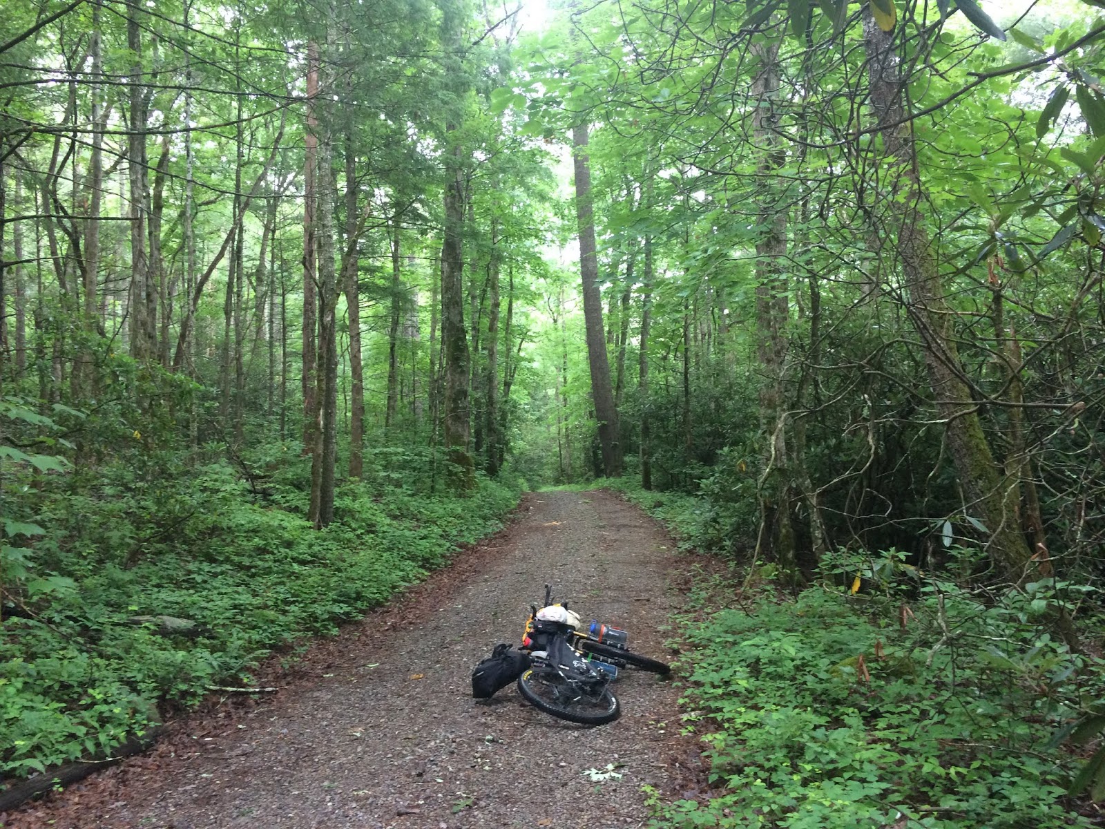
Woke up early from my campsite in the woods and wanted to make China Grove, NC. North Carolina has three different elevation ranges and this would take us out of the low lying areas near the coast and start climbing. The middle portion of the day was spent through the Uwharrie National Forest and going around a set of lakes. There was some really pretty riding in here, and quite a few of those cabins back in the woods with big no trespassing signs. Seems like the ones with the biggest signs were the ones that you would figure had nothing of value that anyone would want anyways ... and usually marked by a traitor flag flying someplace on the property.
 |
| Beautiful Streams |
Ran across some logging near Ophir, but otherwise a pretty hot and uneventful day until I got closer to China Grove. There was a road detour and I rode all the way down to look the construction site over and then elected to take the detour ... turns out some of the other riders went through it, guess I should have gotten off the bike and looked it over better, was maybe a 5 mile detour. Anyways, I got to China Grove, ate at a Hardee's and then camped by the edge of a corn field just outside of town.
Something like 103 miles and 4400 feet for the day.
Day 4 China Grove to Lenoir
Got up pretty early in China Grove and headed for a diner that I knew would be open. Scored on a big breakfast with eggs and country ham and biscuits and gravy ! That's the kind of thing I was looking for last night, but had to settle for Hardee's. ( ugh ).
I stopped in Troutman for breakfast #2 at a BBQ place, and then rolled along. It was a pretty warm day, I think I took one picture of some farmland. Lots and lots of farmland.
Getting to Lenoir, I was still scratching all over from the sand flea bites and the bed bug bites and decided that I wanted a hotel. Turns out in Lenoir, the route is to the south of the city and all of the hotels are north, so I rode about 3 1/2 miles off route to get to one. Ate at a Long John Silver's restaurant and got cleaned up. Someplace in the middle of the night felt sick and almost threw up, but kept it all down. It did feel really good to be clean after 4 nights out and a Benadryl seemed to be helping with the bug bites.
Day 5 Lenoir to Linville
Knew this was going to be a hard day and I wanted to avoid work traffic early in the morning getting from my hotel back to the route on the south end of town, so I think I was up at about 4:30. I went by a diner that I thought would be open but there were closed and had some sort of police bust going on outside, so moved on ... I got to the freeway at the south end of town and missed my exit, riding about another mile or so, then had to turn around and go back up a hill, but finally got out of Lenoir.
And then we were on a beautiful dirt road going up into the mountains, just exactly the thing I needed for my spirits. The weather had cooled and the road was pretty smooth and the grade was great. It started raining and I climbed more and then descended to a little place called Mortimer. On the way, I saw a bunch of box turtles, some digging in the middle of the dirt road to lay their eggs ... I picked up a couple of them and moved them to the side before I realized that's their thing .. to dig in the middle of the road as they must like the soil and there is almost no traffic ( hope that works out guys ). In Mortimer, there is a little general store with an Israeli and American flags out front. She fixed me a roast beef sandwich and a hot dog and I talked to a couple of fisherman for a while on the front porch. It rained pretty much half of the morning and into the early afternoon, but the scenery was just beautiful and the temperature not bad at all.
 |
| Turtle wanted to lay eggs in the road |
 |
| Mortimer, NC .. best sandwich ever |
Somehow I thought it was a quick downhill to Linville. Silly me. I rode a bit and felt something funny with the chain and I stopped ... good I did because another pedal stroke would have ripped off my derailleur, as a rock with asphalt on it was stuck in the chain and about to jam in the pulley wheels. Found it, got it out and then was faced with a pretty much straight up climb. Finally I realized that I was on the back side of Grandmother Mountain ! Don't know why I thought this was downhill ... the downhill part started once I got to the Blue Ridge Parkway at the very top. Finally made the climb ... man it was painful !
There isn't much in Linville, I seem to remember it being bigger. I found a BBQ place and got some food, that was pretty dry actually, and then got a nice hotel room for the night. 61 miles and 7300 feet for the day.
Day 6 Linville to Hickory Fork Tailhead
Pretty uneventful ride into Spruce Pine, found some food and then on to Burnsville, NC where I found a little cafe/coffee shop. Had a great sandwich there and then I rolled for Tennessee. At some point I recall seeing a sign that said Roan Mountain was 15 miles away, so we were way up north now and did more climbing. Then I followed a river for a while and climbed on 19W to the Tennessee state line. That was pretty cool to hit another state.
On a downhill headed in the direction of Erwin, I came around a corner with a groundhog running along in the ditch on the side of the road ... he looked behind himself and realized I was catching up with him and he stopped, stood up and chirped as if to say "ok you caught me but I'll fight you ! "
I got to the TN Visitor Center on I-26 and checked out the vending machines ... they had pretty much everything, soups, stews, a microwave, was pretty impressed by the selection. I watched the lawnmower guys for a while and ate and then rode on, going back into North Carolina.
 |
| Heading to off route campsite |
As it grew dark I didn't see any good places to camp on the road into Hot Springs, so I saw a brown sign for a trailhead at Hickory Fork and took that .. great choice ! I got back into the woods in dense forest, found a nice bench to set my tent up on, heated up some supper and was in the tent before the rain really started !
Day 7 Hickory Fork to Maggie Valley
The next day was a climby day. I took one turn and the road went almost straight up ( well, it seemed like that ).. lots of rain and low clouds. Pretty country.
I stopped in Hot Springs dripping wet from the morning's rain, a little embarrassed at how much water I was leaving on the floor ... but the breakfast there was outstanding !
At some point in the early afternoon, I got up into the woods on a dirt road and heard a thunderstorm above me and then it opened up .. I was by then on a downhill and got back to where some houses were ... there was an old store along the road with a tiny little porch on it and I sat under that porch for a bit as the brunt of the rain hit. It had a little sign on it about I-40 being 15 miles away ... somehow I seemed to peddle 30 or 40 miles before I actually got to I-40.
Once I crossed I-40 the ride to Maggie Valley wasn't too bad, but Maggie Valley was pretty full of traffic and it was one big 4 lane highway, strip mall'ed on either side with lots of fast traffic. Ugh !
Made it to a hotel in Maggie V just before the rain totally dumped. I ate in the restaurant at the hotel there ( Maggie Valley Conference Center I think was the name ) and ordered a steak ... that was the worst steak I have had in a long time.
Day 8 Maggie Valley to Smokemont in GSMNP
Well I wasn't eating at the restaurant at the hotel again and I rolled along in MV for a bit and found another little diner .. another super breakfast, followed by this ridiculous gravelly climb past a few houses ... it was a huff and puff to get to the top of it. Pretty soon I was on the Blue Ridge Parkway.
The riding on the Parkway was nice. It was early enough in the morning and I climbed and then took a seldom used road to get over to Heintooga Round Bottom Road that would take me back down and towards the Cherokee Reservation.
 |
| Heintooga Road ... beautiful |
That road was one of the highlights of the whole trip, as it quickly went into a canopy covered forest, with moss on the sides and middle of the road, wild turkeys walking around and more mist. I came upon one turkey, startled it and watched it take flight and make a beautiful turn to the right. Yes they can fly ... not far, but they can fly !
Several miles later the road stopped at a Cherokee Reservation fish hatchery and the rain started hard. I was pretty soaked and spend several minutes seeking shelter at what was basically a little bus stop shelter. I put on the only dry thing I had and warmed up a little. After that I rode into the Great Smokey Mountains National Park via and up to the Smokemont Campground where I grabbed a spot for the night. As I setup the tent, the rain stopped, but it would come back during the night.
Day 9 Smokemont to Parsons Gap
One thing about GSMNP is that it's probably the most visited National Park. I was up early in the morning and headed up towards Newfound Gap, which is at the peak separating North Carolina and Tennessee. The traffic was pretty light when I started the climb and the rain continued and the mist came in ... it was pretty chilly when I stopped at the top. This was a place I have been to before, I remembered the Rockefeller plaque in the parking lot from childhood visits with my parents to the Smokies. I was pretty bundled up, and quite a few of the tourists were in t shirts and shorts ... but then I was soaked and they had just come out of dry cars.
 |
| Newfound Gap |
 |
| Mamma and two cubs ( to her right past the big tree ) |
 |
| More magical flowers |
 |
| Parsons Gap Road |
A fast downhill section got me down to the Sugarlands entrance to the Park. Talk about a nut house ... it was Sunday and the place was hopping ! I scored a couple of sodas from a vending machine and bought a couple of chocolate bars in the visitor center. Surprisingly, that was the only food options available there, and more surprising was that there was no cell reception ... I know we were close to Gatlinburg and really thought the phone would work, but nope !
Next up was to ride through Cades Cove and that was a pretty good ride, but with lots of traffic behind me ... fortunately, there were lots of pull outs and I could swing over into one of them and most of the cars behind me would get by before I needed to pop back into the main flow .. at some point I saw a line of cars stopped and passed several of them and found everyone was watching a mom black bear and her two cubs.
Finally got to the Cades Cove center, scored a burger and chips and sodas at the camp store, and then rode the 8 mile loop going in the flow of traffic ( ATR had us going the other way for some reason ... that would have been suicidal on this Sunday afternoon ! ). Saw some people trying to get a car started and hear someone say "if we had some Coke we could clean up the corrosion on these battery terminals" ... and I had Coke ! Didn't fix the problem but was interesting to watch everyone problem solve on trying to fix some guy's car.
Finally got to Parson's Gap Road, which had a big closed sign. A fellow and his wife came up behind me and started chatting ... he had all of the Sam's maps for TAT ... basically the motorcycle version of ATR and was really interesting in what I was doing.
Parson's Gap was another beautiful piece of road going through forest. Beautiful flowers in there and it was getting dark and I camped. Turns out I camped about 200 feet from the crest of the high point.
More rain at night.
Day 10 Parsons Gap to Cherola Skyway
Got up, crested that hill and had a nice fast downhill for most of the way to pavement. I managed to scare a bear who ran off the road and got to about mile 3.5 of the Tail of the Dragon. This is a curvy paved road that motorcyclists come from miles around to ride ... 11 miles downhill, back up, back down, on and on. Lucky me, I hit it early Monday morning when the thundering noisy herd had left.
 |
| Skyway |
Stopped at the restaurant in Dales Gap and got breakfast #1, then rode past the Tellico Dam to the Tapoca Inn and stopped there. Was too late for breakfast, but the lady at the desk said lunch would happen at 11 and it was 10:30, so I sat down in a big civilized overstuffed chair in a beautiful "sitting room" and recharged my phone and used their wifi. Five minutes later a major rainstorm came and lasted for about 20 minutes ( I would have drowned ! ). Got my lunch and headed out.
 |
| This view was worth a lot of climbing |
Left there and then through a campground and down a muddy trail that ended at a river. Apparently the track went across to the other side, but all I saw were down trees, briar bushes and places where a couple of someone's had tramped down the grass, but I couldn't see any evidence that anyone went across the river. Then remembered something about using NC 143, so backtracked and ended up on the Cherola Skyway.
That was a really pretty ride. Getting late in the day and I got maybe 8 miles or so of it in, and camped. It rained again and the wind blew. Later in the night I saw lights above the tent ... thought it was distant lightening. I got up and it was some sort of lightening bug, but not the ones I remember as a kid ... these had a spherical light on them vs the cylindrical ones I remember and were much brighter and were there in a little bit of wind. Tried to look them up, but haven't figured out what they were.
Day 11 Cherola Skyway to Tennessee line
Actually crossed into Tennessee twice this day. First I climbed a bit on the Cherola Skyway ( NC 143 ) and then had a pretty beautiful descent and into TN, rode through forest for a bit and then along a river. A bit later in the day I got to what was called a Tennessee Welcome Center, just a little curio shop that had a fridge with soda's and some chips and stuff, but the soda's were awesome. After that I followed part of the Trail of Tears for a bit back into North Carolina. That was a short little piece and it turned back west and I was back into Tennessee. Did some climbing and pretty soon it was close to dark and I camped in the woods.
 |
| Wildlife Linkages .. the poles allow flying squirrels to cross the road |
Day 12 Tennessee line to Dayton
Was another good day. Had a nice downhill to start, rode along another river and got to highway 411 I think. Was hungry and took a little detour to a deli/gas station and got a great cheeseburger. Back to the route and stopped at a little Amish stand and scored some cookies, and then rode through a bunch of Amish farms.
A little later in the day I got to Calhoun, TN and got to ride along the Trail of Tears for a bit. What a national tragedy that was. More riding got me to the Tennessee River and I crossed it and rode in rain into Dayton which was a couple of miles off route from Graysville, TN. Couple of hotels were full, but I found one and it rained that night.
 |
| Tennessee River |
Day 13 We Quit
It was sunny, I got up, ate at a McDonald's and then stopped at a Walmart and got more lithium batteries and something else and was back in Graysville. And then I got chased by another group of dogs and somehow I decided that I had had enough of riding past "some guy's front yard" and I stopped on a hill and sat there for a while. I was going to go on. And then somehow the fact that several others had stopped for various reasons and I was way the heck in the back and probably was going to need 70 to 80 days to finish just weighed on me and it all seemed so damn hopeless.
So I looked at the phone and found a car. And then I checked Uber and they didn't have anything, so I almost started up the hill. But I remembered I had Lyft on my phone, so I checked it and a guy said he'd be there in 15 minutes. So I rolled over to the city office building and he met me and suddenly I was at the Chattanooga airport picking up a car and headed into Alabama.
Driving Back
I drove to Pearl, Mississippi that evening, and up the next morning and into Texas. I stopped at a combination BBQ/gas station/curio place and looked at my phone and Tim was in Salida Ok already and was going to drop. So I drove a few hours up to Salida on Texas back roads with 70 mph speed limits on 2 lane roads ( Texans are nuts ! )
Met Tim at a Subway in Salida, and we managed to get two 29" mountain bikes into the back of a Nissan Sentra without destroying either one of them. We drove to Muskogee, OK ( and yes they smoke marijuana in Muskogee .. I saw the shop that sells weed ) and managed to get a couple of smelly smoking rooms ( yuck ). We drove to Holbrook, AZ and the next morning got up and stopped at the "Standing on the Corner" sign in Winslow, AZ. I dropped Tim off in Flagstaff and headed for Tucson.
 |
| Standing on the Corner - Winslow |
And that was the end of the trip. As I'm writing this Peggy and Adam are going to finish tomorrow with 48 days and Indiana finished on the 4th of July at 34 days. Giovani and Christina ended up on the road riding into San Francisco and the rest of us dropped. I had a half baked plan to ride the western portion and I went to Utah and rode all of one day and managed to bake myself, so I am done with anything long distance for a few months.
I saw a line from a woman who was doing Tour Divide this year and was doing well and she quit in Colorado. She said "the thing I wanted was out of reach and slipping away" and I guess that kinda sums up what happened to me ... I just couldn't see that I could do it and magnified the distance between me and my goal, when all I had to do was just ride each day at a time. Nuts.

No comments:
Post a Comment